.png)


A dehisced fruit, held up by Dr. T R Shankar Raman (Scientist, NCF), its star-shaped form a glimpse into the forest's complexity.
Conservation Coalition
Shared infrastructure for ecological intelligence
A coalition, built from the ground up with restoration practitioners i.e. indigenous and local communities, researchers, institutions, alongside technologists and funders. Together, we are designing open tools for complex ecosystems: modular, memory-aware, and made for commons.
Emerging from place-based conservation challenges in biodiverse, climate-vulnerable regions such as the Nilgiris Biosphere Reserve (NBR), the coalition is not geographically bound. We collaborate across regions to co-create interoperable tools, shared data standards, and collective learning frameworks that can travel i.e. adapting to local ecological and social contexts without flattening their specificity.
.png)
The terrain
While there are many entry points into restoration, meaningful ecological recovery in the NBR and Western Ghats cannot occur without addressing IAP i.e. invasive alien plant species. Lantana camara alone blankets over 1.8 lakh hectares in Tamil Nadu. Alongside Senna spectabilis and Chromolaena odorata, these invasives choke native vegetation, alter fire regimes, starve wildlife, reduce community access to forest produce, and burden departments with spiraling removal costs.
Yet across the landscape, removal—often undertaken in good faith and at great expense—frequently leads to relapse as planning follows action, replanting is delayed and monitoring remains patchy.
Landscapes are being mapped, both undisturbed benchmark sites and heavily altered ecosystems, however restoration efforts are unfolding along parallel tracks.
Some groups focus on invasive removal; others study how invasives interact with native species or human settlements. In parallel, technologists attempt to intervene by mapping landscape-specific natives, scaling nurseries, and developing replantation protocols for forest restoration.
Yet these efforts rarely converge. Data generated at one stage seldom informs decisions at the next; sequencing is fragmented; and interventions are designed in isolation from long-term monitoring, local livelihoods, or landscape memory. The result is well-intentioned work that remains partial, its impact constrained by the absence of shared frameworks, interoperable data, and coordinated planning across the restoration lifecycle.
Our programs working hypothesis is restoration falters not due to insufficient effort but because critical pieces are missing from the systems that guide that effort.

The people behind this effort
_edited.jpg)


Tanya Kak, Associate Director & Head, Climate & Environment at Rohini Nilekani Philanthropies, offers a glimpse into the thinking and intent behind this program
The social sector’s strength depends on how well its systems talk to one another. When data connects and platforms interlink, progress stops being isolated and starts becoming shared. We’ll explore what that shift looks like in practice: from isolated innovation to shared infrastructure, from standalone pilots to connected ecosystems and from vendor-owned to community-owned.


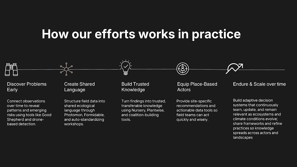
Alignment across three fronts
The Restoration Pipeline
We look at ecological restoration as a continuous pipeline, ensuring invasive detection flows into removal, planning, execution, monitoring, assessment, and advocacy, rather than a stop & start cycle of fragmented interventions.
Integrating the restoration pipeline with technology (where relevant), can magnify ecological recovery compared to isolated restoration efforts. Feedback loops emerge, where removal timelines inform nursery readiness, and growth patterns refine monitoring frameworks.
People in the System
The tools and models are built alongside people immersed in field restoration, anchored in their expertise to shape each component of the system.
By aligning these actors across the restoration pipeline through shared protocols, datasets, and frameworks, their distinct capabilities travel across sites, and uneven expertise and efforts across different restoration stages is stabilised to strengthen on-ground action.
Accumulating Ecological Knowledge
When experiment datasets across organisations are connected and insights are accumulated, ecological understanding improves. Within organisations and programs, we help partners rewire their own data practices where restoration experiments, community initiatives, and governance work can share common identifiers, schemas, and memory, allowing insights to accumulate rather than remain siloed.


The Prototypes
What is emerging through the coalition is a working suite that mirrors how restoration actually unfolds in the field. Conservation rarely begins with neat datasets. We have scattered observations, photographs taken at fixed points, paper forms filled out under difficult conditions, and long walks across transects and plots. The effort here has been to bring these fragments into alignment so that they begin to speak to each other.
A mobile app for field teams to capture restoration progress through visual, time-series monitoring.
The process starts with field capture. Teams document restoration sites through structured photo monitoring and simple paper forms that record observations across different plots and transects. These inputs track ecological indicators such as species presence, disturbances, and landscape change. The system is designed to work under real field conditions, which means mobile applications function offline and allow teams to systematically capture photographs and notes even in remote landscapes.
Data forms are automatically digitised by uploading a photo of the sheet, eliminating manual data entry. The system extracts table and field data, while allowing human corrections that progressively improve detection and contextual accuracy.
Paper remains an important part of the workflow. Many teams continue to rely on handwritten forms during field surveys. The platform therefore includes a mechanism to upload paper forms and automatically detect fields, titles, and handwritten entries.
These can then be edited and corrected so that variations in handwriting do not compromise the analysis. The intention is not to replace field practices but to translate them into usable datasets without adding unnecessary friction.
Once captured, these different streams of information begin to move through the system. Data collected from monitoring plots feeds into planning processes, particularly for nurseries and restoration interventions. At the same time, models such as Alienwise analyse invasive species presence and forecast potential spread across landscapes. Instead of working in isolation, field observations and modelling outputs inform one another, allowing restoration teams to interpret what is happening on the ground with greater clarity.
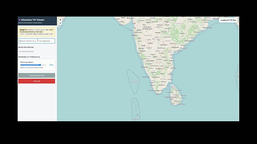
Alienwise, a tool under development to understand interactions between different invasive species, spot degradation corridors that are often inaccessible by foot for invasive detection to guide restoration teams.

The experiment builder enables researchers and program coordinators to map the structure of sampling sites and transect blocks. The system parses experiment protocol documents and KML files to infer and reconstruct field and block configurations.
Additional signals enter the system through sensors and guided field confirmations. These help identify disturbances & ecological disruptions. When these signals are combined with field observations and model outputs, they create a more layered understanding of how landscapes are changing.
This intelligence then feeds directly into decision making. It helps determine which species should be prioritised, how nurseries should plan their stock, and where interventions should take place. The same system also supports the design of experiments and restoration protocols, allowing researchers to test different approaches while maintaining consistent documentation across sites. Spatial protocols can be visualised through KML layers, helping teams map interventions and monitoring locations.

A visual time-lapse of ecological recovery: photos captured from a fixed station over time show canopy closure and the emergence of native saplings in the understory. Assisted by natural language querying for quicker analysis.
Planting and intervention tracking are supported through dedicated tools such as NCF’s Plantwise, which connect nursery planning with field implementation. Monitoring does not end after planting. The system continues to track visual and ecological indicators over time, helping teams understand whether restoration strategies are working.

Back in the office, desktop applications allow researchers, analysts, and field teams to review the information gathered in the field. They can analyse visual changes over time through photo monitoring, query survey responses and observation notes, and examine site-specific questions that emerge from the data. Tools such as the Indicator Wizard not only help standardise field data but also help translate raw field observations into meaningful ecological indicators that can guide the next cycle of monitoring.


Taken together, the suite forms a reinforcement loop. Field observations inform models and planning. Planning guides interventions. Interventions are monitored again through structured documentation in the field. Over time, the system accumulates both ecological knowledge and operational learning, helping restoration efforts move from isolated projects to coordinated, data-informed landscape recovery.
What potential does this hold for the sector?
This lays the groundwork for a shared conservation intelligence infrastructure.
A system that could allow:
-
Restoration ecologists across geographies to compare regeneration timelines
-
Forest department & Self Help Groups to forecast invasive spread and plan interventions proactively
-
Researchers to layer phenology, biomass, and biodiversity records into a single ecological timeline
-
Funders and policymakers to see conservation not as anecdote, but as evidence
This work is supported by


.png)
Recognitions
